Description
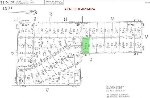
4.9 Acres (APN: 3310-028-024) GPS: 34.748683, -117.903118 This 5+ acres is west of Lancaster, CA. This property is 5.2 miles outside of the city limits of Lancaster. The area is mostly small ranches or farms. According to the Los Angeles County the property is zoned A-2-5 Heavy Agriculture. Single family residences, crops, greenhouses, raising of cattle (horses, sheep, goats, poultry), animal hospitals, dairies, dog kennels and livestock feed lots are permitted uses in the area. Solar energy facilities may be permitted or require a CUP, Buyers should speak with LA County planners for all requirements. Residential electricity is approximately 25 feet north. Residents in the area have private wells for water, propane tanks for gas and septic systems for sewer. Lancaster is separated from the Los Angeles Basin by the San Gabriel Mountains to the south, and from Bakersfield and the San Joaquin Valley by the Tehachapi Mountains to the north. The city has continued its growth since the 1930's. Lancaster is now home to major defense contractors such as Boeing, Northrop Grumman, Lockheed Martin, BAE Systems, and government agencies, such as the NASA Armstrong Flight Research Center, which are all active in design, testing, and manufacturing of a variety of military and commercial equipment. This property does not yet have an address, the address listed is for marketing purposes only. While the boundary lines on the map offer a glimpse, they are only approximate. A Buyer should verify boundaries, zoning and utilities, ensuring every aspect aligns with their vision for the property.
Map Location
Listing provided courtesy of Kristen Maley of Landcore Realty. Last updated 2024-12-07 10:18:36.000000. Listing information © 2024 PACIFICSOTHEBYSFULLSANDICORCOMBINED.


